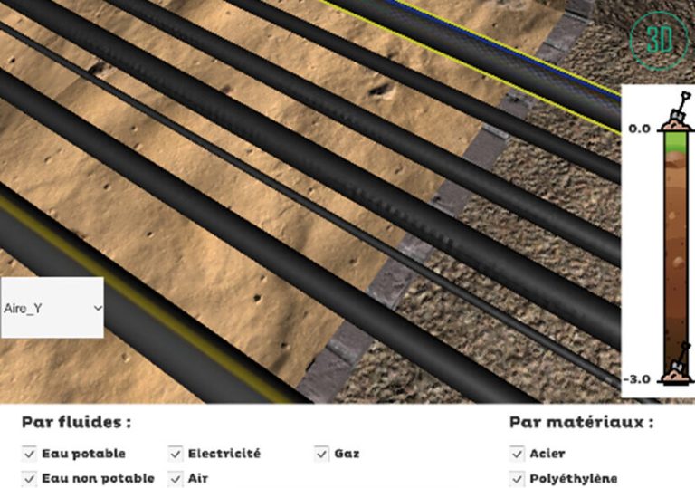

The contribution of new technologies for augmented reality visualization is one of the pillars of the strategy to reduce damage to structures: tomorrow, it will be possible on the construction site to visualize buried pipes in augmented reality and in real time from a smartphone or tablet, with sub-centimetric precision. These data would be taken from the Geographic Information System (GIS) of the various network operators, and from the sensors used to locate the pipes. It is the combination of all these technological bricks on which RICE is working with its partners that will make it possible to achieve this ambitious objective.
The TransparenSee application |Simplified use for the operator|Promising prospects for the prevention of damage to structures|And soon I-ClouTransparenSee is an augmented reality application that allows you to detect and visualize buried networks realistically and with great precision. Tested at RICE in the network detection test area of the Villeneuve la Garenne site, it was designed in partnership with students from the Arts et Métiers of Angers and the AMVALOR laboratory. The application takes advantage of the most advanced visualization and relocation technologies, merging SLAM(simultaneous localization and mapping), LIDAR and GNSS data. By scanning the detection area in three dimensions, the development teams located the buried pipes and generated a digital duplicate. The interest of the system lies in the visual rendering of these pipes within the application. This tool is particularly useful for public works companies in order to locate, to the nearest centimetre, the multiple buried networks and thus ensure the safety of earthmoving operations and avoid damage to the structures.|The user has the possibility to visualize the pipes and obtain information about their constituent material or the fluids they carry. The application works by default with a configuration saved on the device. If the topology of the site changes, a new relocation configuration can be created to ensure the continuity of the experience.|For the time being, TransparenSee requires the downloading of positioning data provided by the operators for their structures. Still in the development stage, large-scale application will be made possible by :